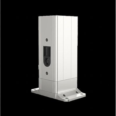
Description du produit :
Molas 3D est un système lidar de mesure du vent Doppler avancé qui fonctionne grâce à une technologie de balayage tridimensionnel. Il est basé sur le principe du décalage de fréquence Doppler cohérent par laser pulsé, ce qui permet une détection précise de la vitesse et de la direction du vent en temps réel.
Cet appareil sophistiqué prend en charge plusieurs modes de balayage, notamment P-Pl, RHl, DBS et le balayage programmé, offrant des options polyvalentes pour diverses applications. Sa flexibilité lui permet d'être adapté pour répondre aux exigences de différents scénarios de mesure du vent.
Molas 3D est particulièrement adapté aux utilisations spécialisées telles que l'évaluation des ressources éoliennes offshore, les études en terrain complexe, la détection des sillages d'éoliennes et les avertissements de cisaillement du vent sur les trajectoires d'approche des aéroports. De plus, il est efficace pour les observations météorologiques urbaines et la détection des turbulences en haute altitude, ce qui en fait un outil complet pour divers besoins de surveillance environnementale.
Caractéristiques :
Informations de mesure riches
Le système fournit des mesures détaillées du champ de vent tridimensionnel avec une résolution affinée.
Il prend en charge jusqu'à 300 couches de distance personnalisables, ce qui permet une collecte de données très précise.
Portée étendue
Équipé d'une capacité de détection visuelle allant jusqu'à 10 kilomètres, le système surveille efficacement les zones situées en dessous de 600 mètres de hauteur.
Cela garantit une couverture d'observation large et complète.
Haute précision
L'appareil atteint une précision de pointage exceptionnelle de 0,005°, accompagnée d'une précision de la vitesse du vent directionnel visuel de 0,1 mètre par seconde.
Une telle précision garantit des mesures fiables et précises dans diverses conditions de fonctionnement.
Diverses méthodes de balayage
Plusieurs modes de balayage sont pris en charge, notamment PPI, RHI, DBS et des méthodes de balayage arbitraires programmables.
Cette flexibilité permet aux utilisateurs d'adapter les modèles de balayage à des applications et des exigences spécifiques.
Déploiement flexible
Conçu pour être compact et léger, le système peut être facilement déplacé et installé dans différents environnements.
Cette fonctionnalité améliore son adaptabilité et sa commodité sur le terrain.
Durabilité par tous les temps
L'équipement est conçu pour résister aux conditions extérieures difficiles sans compromettre les performances.
Il est conforme aux normes de survie LPz0 et comprend une protection contre la foudre.
Utilisation sûre
La sécurité est assurée grâce à la fonction de rapport de localisation GPS intégrée et aux capacités de géo-clôture.
De plus, les mesures de cryptage des données éliminent efficacement le risque de fuite de données.
Plusieurs options de configuration
Les utilisateurs peuvent choisir parmi quatre résolutions de distance différentes et cinq temps d'accumulation, ce qui permet un fonctionnement personnalisable adapté aux différents besoins de mesure.
Paramètres techniques :
|
Distance de détection visuelle
|
10 km
|
|
Plage verticale
|
-10~190°
|
|
Distance de mesure verticale
|
4 km
|
|
Méthode de balayage
|
PPI, RHI, DBS et balayage programmé
|
|
Couches de distance
|
Jusqu'à 300
|
|
Durée de stockage des données
|
5 à 18 mois
|
|
Résolution de distance
|
15 m / 30 m / 75 m / 120 m
|
|
Sortie de données
|
Profibus DP / Modbus TCP / CAN en option
|
|
Plage de vitesse du vent visuel
|
-75~+75 m/s
|
|
Taille
|
756 mm × 735 mm × 1000 mm
|
Ce produit lidar de vent est conçu pour les applications de télédétection et est idéal pour les solutions de location de lidar nécessitant des capacités de mesure du vent avancées.
Applications :
L'évaluation des ressources éoliennes implique la mesure des informations sur le champ de vent sur une vaste zone, ce qui permet de réduire les risques associés à la sélection des sites pour les projets d'énergie éolienne. En évaluant avec précision les ressources éoliennes potentielles, les développeurs peuvent prendre des décisions plus éclairées et améliorer la viabilité des parcs éoliens.
Les mesures de la courbe de puissance à longue distance et les mesures des courants de Foucault de sillage sont essentielles pour optimiser l'utilisation de l'énergie éolienne. Ces techniques permettent d'améliorer l'efficacité des éoliennes en réduisant les effets de sillage et en améliorant les performances globales des unités.
La détection et l'alerte précoces des phénomènes météorologiques dangereux, tels que le cisaillement du vent et les rafales descendantes, jouent un rôle crucial dans la sécurité. La surveillance de ces événements permet des alertes en temps opportun qui peuvent protéger à la fois les opérations aériennes et les activités au sol.
La mesure des vortex de sillage est également importante pour optimiser la séparation des vols dans les aéroports. Cela permet une gestion plus sûre et plus efficace du trafic aérien en minimisant le risque d'incidents liés aux turbulences.
La fourniture d'informations détaillées sur le champ de vent permet de comprendre l'état du vent dans la couche limite atmosphérique. Ces données sont vitales pour diverses études météorologiques et environnementales.
Des informations de profil de vent de haute précision et à haute résolution spatio-temporelle à quelques kilomètres de la surface comblent une lacune critique dans les observations à basse altitude. De telles mesures précises soutiennent de meilleures prévisions météorologiques et une meilleure surveillance environnementale.
Les informations tridimensionnelles en temps réel sur la dispersion des panaches sont utilisées pour suivre efficacement les sources d'émission. Cette capacité est importante pour la protection de l'environnement et la conformité réglementaire.
De plus, l'optimisation du contrôle des émissions de poussières dans l'industrie minière repose sur des données précises sur le vent afin de minimiser l'impact environnemental. En surveillant les schémas de dispersion des poussières, les opérations minières peuvent mettre en œuvre des stratégies d'atténuation plus efficaces.

 Votre message doit contenir entre 20 et 3 000 caractères!